


GTDV J4

PhilippeC54
User

Length
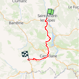
37 km

Max alt
1317 m

Uphill gradient
1079 m
Km-Effort
52 km

Min alt
673 m

Downhill gradient
1333 m
Boucle
No
Creation date :
2019-07-03 06:56:10.594
Updated on :
2019-07-03 20:10:59.042
5h15
Difficulty : Very easy

FREE GPS app for hiking
 SityTrail
IGN / Geographical institutes
SityTrail Plus
The world is yours!
About
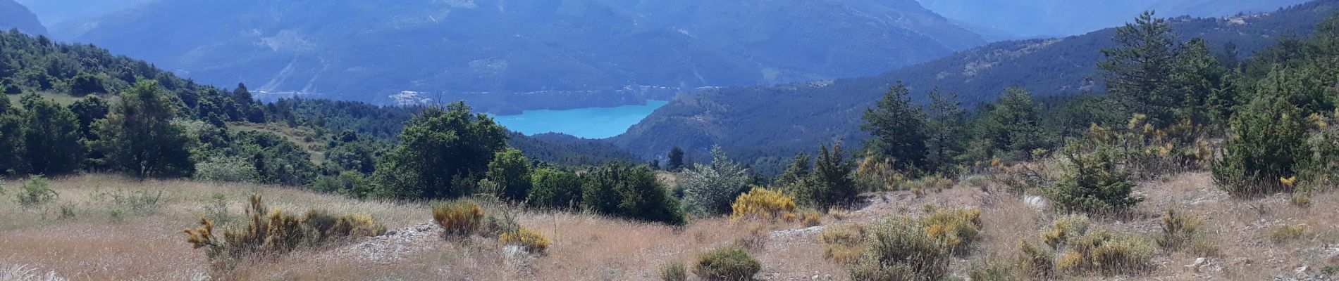
Trail Mountain bike of 37 km to be discovered at Provence-Alpes-Côte d'Azur, Alpes-de-Haute-Provence, Saint-André-les-Alpes. This trail is proposed by PhilippeC54.
Photos

Positioning
Country:
France
Region :
Provence-Alpes-Côte d'Azur
Department/Province :
Alpes-de-Haute-Provence
Municipality :
Saint-André-les-Alpes
Location:
Unknown
Start:(Dec)
Start:(UTM)
299718 ; 4871145 (32T) N.
Comments