


Source du Dourzon

jdelettrez
User

Length
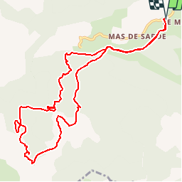
12.1 km

Max alt
731 m

Uphill gradient
329 m
Km-Effort
16.5 km

Min alt
513 m

Downhill gradient
328 m
Boucle
Yes
Creation date :
2019-07-03 21:23:03.509
Updated on :
2019-07-03 21:23:44.756
3h30
Difficulty : Difficult

FREE GPS app for hiking
 SityTrail
IGN / Geographical institutes
SityTrail Plus
The world is yours!
About
Trail Walking of 12.1 km to be discovered at Occitania, Aveyron, Nant. This trail is proposed by jdelettrez.
Positioning
Country:
France
Region :
Occitania
Department/Province :
Aveyron
Municipality :
Nant
Location:
Unknown
Start:(Dec)
Start:(UTM)
522898 ; 4871595 (31T) N.
Comments