


venasques

nouga
User
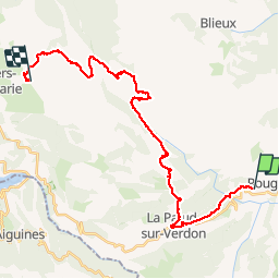

Length
29 km

Max alt
1539 m

Uphill gradient
1111 m
Km-Effort
44 km

Min alt
697 m

Downhill gradient
1017 m
Boucle
No
Creation date :
2019-07-04 06:46:10.789
Updated on :
2019-07-04 17:37:10.995
7h07
Difficulty : Very easy

FREE GPS app for hiking
 SityTrail
IGN / Geographical institutes
SityTrail Plus
The world is yours!
About
Trail Mountain bike of 29 km to be discovered at Provence-Alpes-Côte d'Azur, Alpes-de-Haute-Provence, Rougon. This trail is proposed by nouga.
Description
tranquille tranquille
Positioning
Country:
France
Region :
Provence-Alpes-Côte d'Azur
Department/Province :
Alpes-de-Haute-Provence
Municipality :
Rougon
Location:
Unknown
Start:(Dec)
Start:(UTM)
290201 ; 4852559 (32T) N.
Comments