


Conliege Les voies PLM page 151

grasgilbert
User
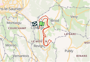

Length
16.4 km

Max alt
561 m

Uphill gradient
612 m
Km-Effort
25 km

Min alt
319 m

Downhill gradient
612 m
Boucle
Yes
Creation date :
2019-07-04 07:50:47.979
Updated on :
2021-08-19 16:59:23.068
6h30
Difficulty : Difficult

FREE GPS app for hiking
 SityTrail
IGN / Geographical institutes
SityTrail Plus
The world is yours!
About
Trail Walking of 16.4 km to be discovered at Bourgogne-Franche-Comté, Jura, Conliège. This trail is proposed by grasgilbert.
Description
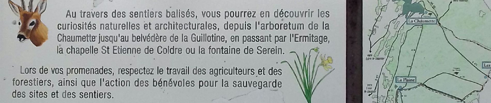
Les voies PLM
Photos


Positioning
Country:
France
Region :
Bourgogne-Franche-Comté
Department/Province :
Jura
Municipality :
Conliège
Location:
Unknown
Start:(Dec)
Start:(UTM)
698959 ; 5169871 (31T) N.
Comments