


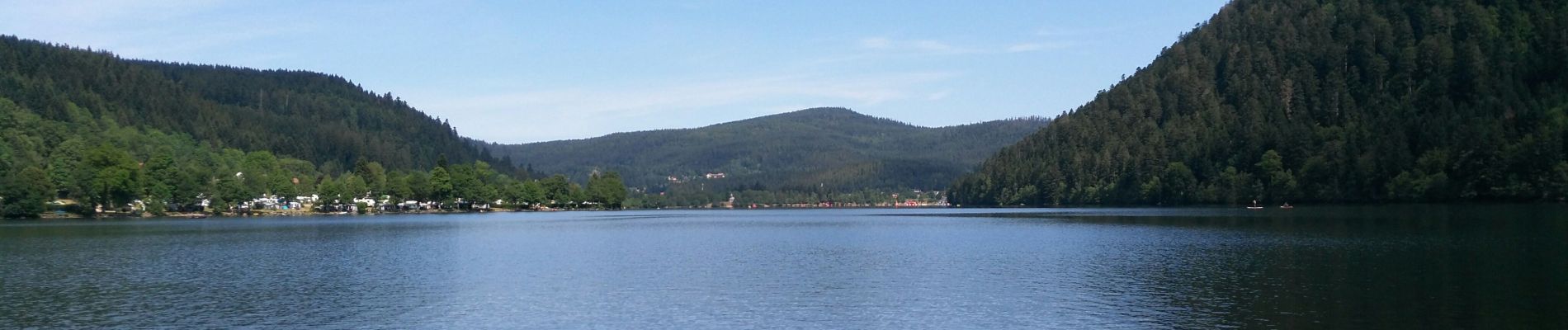
Lac de Xonrupt-Longemer

anjodena
User
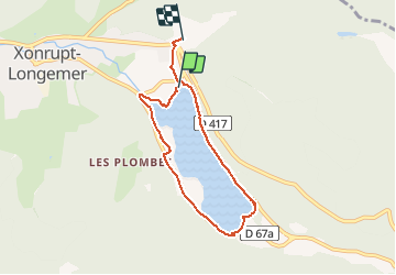

Length
5.8 km

Max alt
764 m

Uphill gradient
84 m
Km-Effort
6.9 km

Min alt
732 m

Downhill gradient
72 m
Boucle
No
Creation date :
2019-07-06 08:40:00.82
Updated on :
2019-07-06 10:08:47.372
1h27
Difficulty : Very easy

FREE GPS app for hiking
 SityTrail
IGN / Geographical institutes
SityTrail Plus
The world is yours!
About
Trail Walking of 5.8 km to be discovered at Grand Est, Vosges, Xonrupt-Longemer. This trail is proposed by anjodena.
Photos


Positioning
Country:
France
Region :
Grand Est
Department/Province :
Vosges
Municipality :
Xonrupt-Longemer
Location:
Unknown
Start:(Dec)
Start:(UTM)
347121 ; 5327081 (32U) N.
Comments