


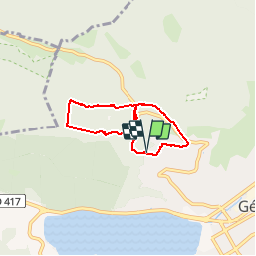
Parcours santé/Gérardmer

micheldutilleul
User

Length
5.1 km

Max alt
927 m

Uphill gradient
162 m
Km-Effort
7.2 km

Min alt
778 m

Downhill gradient
171 m
Boucle
Yes
Creation date :
2019-07-07 07:53:38.972
Updated on :
2019-07-07 09:55:39.685
1h35
Difficulty : Easy

FREE GPS app for hiking
 SityTrail
IGN / Geographical institutes
SityTrail Plus
The world is yours!
About
Trail Walking of 5.1 km to be discovered at Grand Est, Vosges, Gérardmer. This trail is proposed by micheldutilleul.
Positioning
Country:
France
Region :
Grand Est
Department/Province :
Vosges
Municipality :
Gérardmer
Location:
Unknown
Start:(Dec)
Start:(UTM)
340408 ; 5327343 (32U) N.
Comments