


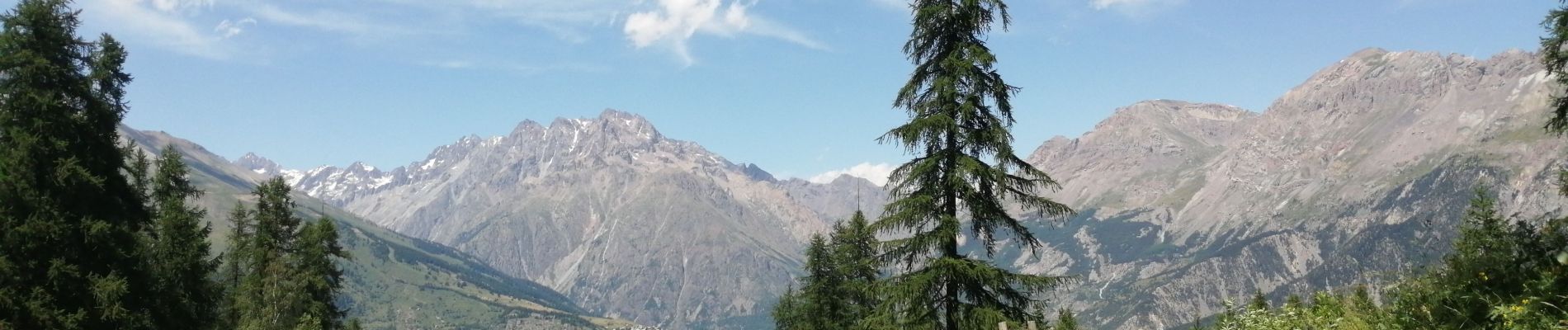
cascades puy saint vincent

sergio19
User
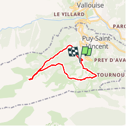

Length
11.6 km

Max alt
2101 m

Uphill gradient
559 m
Km-Effort
19 km

Min alt
1699 m

Downhill gradient
558 m
Boucle
Yes
Creation date :
2019-07-08 07:57:22.575
Updated on :
2019-07-08 13:37:47.813
4h24
Difficulty : Easy

FREE GPS app for hiking
 SityTrail
IGN / Geographical institutes
SityTrail Plus
The world is yours!
About
Trail Walking of 11.6 km to be discovered at Provence-Alpes-Côte d'Azur, Hautes-Alpes, Puy-Saint-Vincent. This trail is proposed by sergio19.
Description
Depart Puy saint vincent 1800
Vers cascades retour par puy saint vincent 2000
Photos


Positioning
Country:
France
Region :
Provence-Alpes-Côte d'Azur
Department/Province :
Hautes-Alpes
Municipality :
Puy-Saint-Vincent
Location:
Unknown
Start:(Dec)
Start:(UTM)
300812 ; 4965802 (32T) N.
Comments