


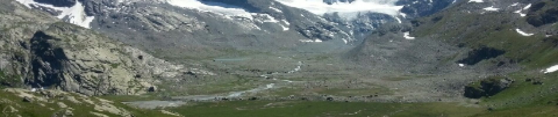
Refuge des Evettes

freche
User
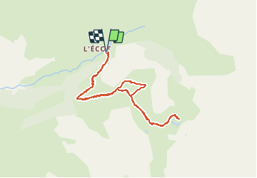

Length
8.9 km

Max alt
2594 m

Uphill gradient
568 m
Km-Effort
16.4 km

Min alt
2023 m

Downhill gradient
568 m
Boucle
Yes
Creation date :
2014-12-10 00:00:00.0
Updated on :
2014-12-10 00:00:00.0
2h48
Difficulty : Easy

FREE GPS app for hiking
 SityTrail
IGN / Geographical institutes
SityTrail Plus
The world is yours!
About
Trail Walking of 8.9 km to be discovered at Auvergne-Rhône-Alpes, Savoy, Bonneval-sur-Arc. This trail is proposed by freche.
Description
départ de l'Ecot
Photos


Positioning
Country:
France
Region :
Auvergne-Rhône-Alpes
Department/Province :
Savoy
Municipality :
Bonneval-sur-Arc
Location:
Unknown
Start:(Dec)
Start:(UTM)
350486 ; 5026888 (32T) N.
Comments