


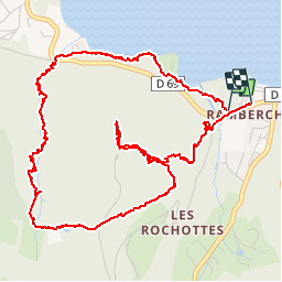
Tour de Mérelle

micheldutilleul
User

Length
6.4 km

Max alt
891 m

Uphill gradient
329 m
Km-Effort
10.8 km

Min alt
659 m

Downhill gradient
332 m
Boucle
Yes
Creation date :
2019-07-08 13:50:05.773
Updated on :
2019-07-08 16:39:26.919
2h26
Difficulty : Medium

FREE GPS app for hiking
 SityTrail
IGN / Geographical institutes
SityTrail Plus
The world is yours!
About
Trail Walking of 6.4 km to be discovered at Grand Est, Vosges, Gérardmer. This trail is proposed by micheldutilleul.
Positioning
Country:
France
Region :
Grand Est
Department/Province :
Vosges
Municipality :
Gérardmer
Location:
Unknown
Start:(Dec)
Start:(UTM)
340024 ; 5325706 (32U) N.
Comments