


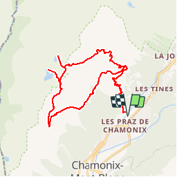
Lac Noir - Lac Cornu (Bivouac) par la Flégère

gregou74
User

Length
22 km

Max alt
2542 m

Uphill gradient
1851 m
Km-Effort
47 km

Min alt
1069 m

Downhill gradient
1852 m
Boucle
Yes
Creation date :
2019-07-08 19:08:52.925
Updated on :
2019-07-12 19:38:34.648
6h34
Difficulty : Very difficult

FREE GPS app for hiking
 SityTrail
IGN / Geographical institutes
SityTrail Plus
The world is yours!
About
Trail Walking of 22 km to be discovered at Auvergne-Rhône-Alpes, Upper Savoy, Chamonix-Mont-Blanc. This trail is proposed by gregou74.
Positioning
Country:
France
Region :
Auvergne-Rhône-Alpes
Department/Province :
Upper Savoy
Municipality :
Chamonix-Mont-Blanc
Location:
Unknown
Start:(Dec)
Start:(UTM)
336319 ; 5089973 (32T) N.
Comments