


L abbaye de valcroissant

raygautier
User
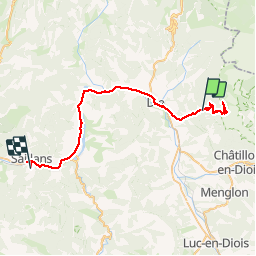

Length
48 km
Boucle
No
Creation date :
2019-07-04 05:15:44.0
Updated on :
2019-07-10 07:29:02.082
9h42
Difficulty : Unknown

FREE GPS app for hiking
 SityTrail
IGN / Geographical institutes
SityTrail Plus
The world is yours!
About
Trail Walking of 48 km to be discovered at Auvergne-Rhône-Alpes, Drôme, Die. This trail is proposed by raygautier.
Description
Rando sympa
Positioning
Country:
France
Region :
Auvergne-Rhône-Alpes
Department/Province :
Drôme
Municipality :
Die
Location:
Unknown
Start:(Dec)
Start:(UTM)
692574 ; 4957544 (31T) N.
Comments