


2019 07 SAINT CHERON T1

michel1025
User
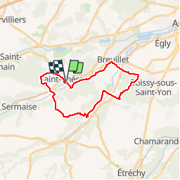

Length
24 km
Boucle
Yes
Creation date :
2019-07-11 07:47:12.0
Updated on :
2019-07-11 15:18:19.884
6h10
Difficulty : Unknown

FREE GPS app for hiking
 SityTrail
IGN / Geographical institutes
SityTrail Plus
The world is yours!
About
Trail Walking of 24 km to be discovered at Ile-de-France, Essonne, Saint-Chéron. This trail is proposed by michel1025.
Positioning
Country:
France
Region :
Ile-de-France
Department/Province :
Essonne
Municipality :
Saint-Chéron
Location:
Unknown
Start:(Dec)
Start:(UTM)
435587 ; 5377988 (31U) N.
Comments