


Rando Le CLAPIER

trailer.nono
User
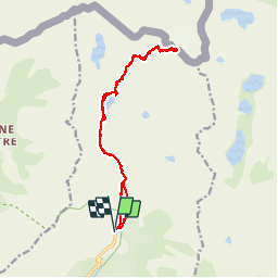

Length
16.4 km

Max alt
3023 m

Uphill gradient
1369 m
Km-Effort
35 km

Min alt
1686 m

Downhill gradient
1372 m
Boucle
Yes
Creation date :
2019-07-14 06:19:57.346
Updated on :
2019-07-14 18:25:47.812
5h46
Difficulty : Very easy

FREE GPS app for hiking
 SityTrail
IGN / Geographical institutes
SityTrail Plus
The world is yours!
About
Trail Walking of 16.4 km to be discovered at Provence-Alpes-Côte d'Azur, Maritime Alps, Belvédère. This trail is proposed by trailer.nono.
Positioning
Country:
France
Region :
Provence-Alpes-Côte d'Azur
Department/Province :
Maritime Alps
Municipality :
Belvédère
Location:
Unknown
Start:(Dec)
Start:(UTM)
371858 ; 4881290 (32T) N.
Comments