


circuit des canaux puy saint vincent

sergio19
User
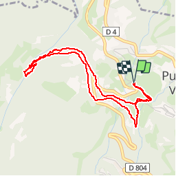

Length
4.7 km

Max alt
1621 m

Uphill gradient
168 m
Km-Effort
6.9 km

Min alt
1461 m

Downhill gradient
167 m
Boucle
Yes
Creation date :
2019-07-18 09:30:19.736
Updated on :
2019-07-18 11:42:44.872
1h36
Difficulty : Easy

FREE GPS app for hiking
 SityTrail
IGN / Geographical institutes
SityTrail Plus
The world is yours!
About
Trail Walking of 4.7 km to be discovered at Provence-Alpes-Côte d'Azur, Hautes-Alpes, Puy-Saint-Vincent. This trail is proposed by sergio19.
Description
Randonnée sur l historique des canaux de puy saint vincent
Départ au niveau de la maison du miel
Positioning
Country:
France
Region :
Provence-Alpes-Côte d'Azur
Department/Province :
Hautes-Alpes
Municipality :
Puy-Saint-Vincent
Location:
Unknown
Start:(Dec)
Start:(UTM)
301244 ; 4966919 (32T) N.
Comments