


Chamois aillefroide

sergio19
User
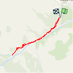

Length
4 km

Max alt
1639 m

Uphill gradient
109 m
Km-Effort
5.4 km

Min alt
1534 m

Downhill gradient
107 m
Boucle
Yes
Creation date :
2019-07-18 15:53:26.233
Updated on :
2019-07-19 08:12:12.09
3h48
Difficulty : Very easy

FREE GPS app for hiking
 SityTrail
IGN / Geographical institutes
SityTrail Plus
The world is yours!
About
Trail Walking of 4 km to be discovered at Provence-Alpes-Côte d'Azur, Hautes-Alpes, Vallouise-Pelvoux. This trail is proposed by sergio19.
Description
Sortie chamois à faire le soir
Si pas dans ce secteur continuer sur le sentier
Ne pas tenir compte de la durée
Positioning
Country:
France
Region :
Provence-Alpes-Côte d'Azur
Department/Province :
Hautes-Alpes
Municipality :
Vallouise-Pelvoux
Location:
Pelvoux
Start:(Dec)
Start:(UTM)
298035 ; 4973186 (32T) N.
Comments