


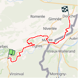
SAT-3-Olloy-Doische

guy284
User

Length
23 km

Max alt
260 m

Uphill gradient
597 m
Km-Effort
31 km

Min alt
130 m

Downhill gradient
567 m
Boucle
No
Creation date :
2019-07-19 17:00:47.129
Updated on :
2019-07-19 17:01:58.396
6h30
Difficulty : Very difficult

FREE GPS app for hiking
 SityTrail
IGN / Geographical institutes
SityTrail Plus
The world is yours!
About
Trail Walking of 23 km to be discovered at Wallonia, Namur, Viroinval. This trail is proposed by guy284.
Description
Tracé selon GPX
Positioning
Country:
Belgium
Region :
Wallonia
Department/Province :
Namur
Municipality :
Viroinval
Location:
Olloy-sur-Viroin
Start:(Dec)
Start:(UTM)
615029 ; 5547974 (31U) N.
Comments