


Les crêtes du tarbesou par rabassols

babouille
User
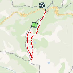

Length
10.1 km

Max alt
2351 m

Uphill gradient
418 m
Km-Effort
16.9 km

Min alt
1927 m

Downhill gradient
799 m
Boucle
No
Creation date :
2019-07-25 05:42:37.924
Updated on :
2019-07-25 10:00:38.13
4h16
Difficulty : Very easy

FREE GPS app for hiking
 SityTrail
IGN / Geographical institutes
SityTrail Plus
The world is yours!
About
Trail Walking of 10.1 km to be discovered at Occitania, Ariège, Mijanès. This trail is proposed by babouille.
Positioning
Country:
France
Region :
Occitania
Department/Province :
Ariège
Municipality :
Mijanès
Location:
Unknown
Start:(Dec)
Start:(UTM)
415716 ; 4729556 (31T) N.
Comments