


E6-Vosgess

pascal.dabet
User
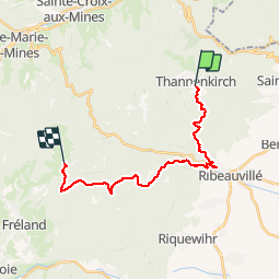

Length
19.2 km

Max alt
940 m

Uphill gradient
900 m
Km-Effort
30 km

Min alt
257 m

Downhill gradient
582 m
Boucle
No
Creation date :
2019-07-26 06:37:50.068
Updated on :
2019-07-26 18:48:16.882
7h27
Difficulty : Very easy

FREE GPS app for hiking
 SityTrail
IGN / Geographical institutes
SityTrail Plus
The world is yours!
About
Trail Walking of 19.2 km to be discovered at Grand Est, Haut-Rhin, Thannenkirch. This trail is proposed by pascal.dabet.
Positioning
Country:
France
Region :
Grand Est
Department/Province :
Haut-Rhin
Municipality :
Thannenkirch
Location:
Unknown
Start:(Dec)
Start:(UTM)
373972 ; 5343242 (32U) N.
Comments