


Saint Antonin

poule16
User
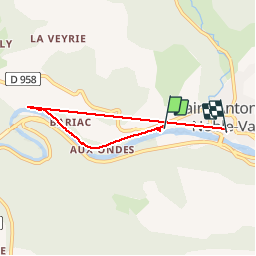

Length
5.1 km

Max alt
241 m

Uphill gradient
190 m
Km-Effort
7.7 km

Min alt
117 m

Downhill gradient
193 m
Boucle
No
Creation date :
2019-07-28 10:40:00.0
Updated on :
2019-07-28 12:51:22.607
43m
Difficulty : Unknown

FREE GPS app for hiking
 SityTrail
IGN / Geographical institutes
SityTrail Plus
The world is yours!
About
Trail Walking of 5.1 km to be discovered at Occitania, Tarn-et-Garonne, Saint-Antonin-Noble-Val. This trail is proposed by poule16.
Positioning
Country:
France
Region :
Occitania
Department/Province :
Tarn-et-Garonne
Municipality :
Saint-Antonin-Noble-Val
Location:
Unknown
Start:(Dec)
Start:(UTM)
399660 ; 4889450 (31T) N.
Comments