


Ploubazlanec

gdela
User
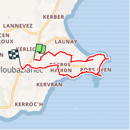

Length
6.2 km

Max alt
60 m

Uphill gradient
101 m
Km-Effort
7.5 km

Min alt
1 m

Downhill gradient
97 m
Boucle
No
Creation date :
2019-07-28 13:58:02.402
Updated on :
2019-08-04 10:24:01.146
2h03
Difficulty : Easy

FREE GPS app for hiking
 SityTrail
IGN / Geographical institutes
SityTrail Plus
The world is yours!
About
Trail Walking of 6.2 km to be discovered at Brittany, Côtes-d'Armor, Ploubazlanec. This trail is proposed by gdela.
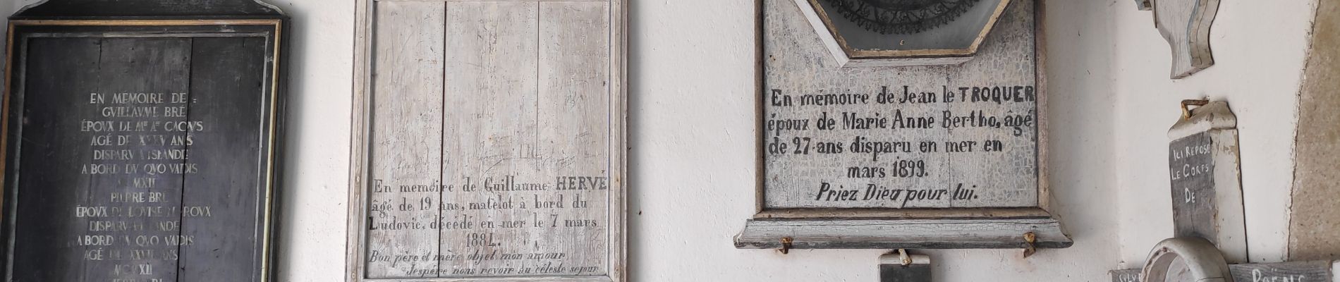
Photos


Positioning
Country:
France
Region :
Brittany
Department/Province :
Côtes-d'Armor
Municipality :
Ploubazlanec
Location:
Unknown
Start:(Dec)
Start:(UTM)
497963 ; 5405563 (30U) N.
Comments