


Rando 2 - Croix Scaille

libertju
User
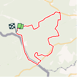

Length
16 km

Max alt
513 m

Uphill gradient
440 m
Km-Effort
22 km

Min alt
298 m

Downhill gradient
437 m
Boucle
Yes
Creation date :
2019-07-29 13:59:50.39
Updated on :
2019-08-12 13:56:56.731
2h35
Difficulty : Medium

FREE GPS app for hiking
 SityTrail
IGN / Geographical institutes
SityTrail Plus
The world is yours!
About
Trail Walking of 16 km to be discovered at Wallonia, Namur, Gedinne. This trail is proposed by libertju.

Positioning
Country:
Belgium
Region :
Wallonia
Department/Province :
Namur
Municipality :
Gedinne
Location:
Bourseigne-Neuve
Start:(Dec)
Start:(UTM)
632347 ; 5534861 (31U) N.
Comments