


Forêt de gresigne

poule16
User
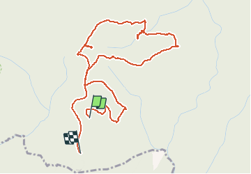

Length
5.7 km

Max alt
355 m

Uphill gradient
158 m
Km-Effort
7.7 km

Min alt
268 m

Downhill gradient
138 m
Boucle
No
Creation date :
2019-07-30 13:28:32.0
Updated on :
2019-07-31 07:36:02.578
1h26
Difficulty : Unknown

FREE GPS app for hiking
 SityTrail
IGN / Geographical institutes
SityTrail Plus
The world is yours!
About
Trail Walking of 5.7 km to be discovered at Occitania, Tarn, Castelnau-de-Montmiral. This trail is proposed by poule16.
Positioning
Country:
France
Region :
Occitania
Department/Province :
Tarn
Municipality :
Castelnau-de-Montmiral
Location:
Unknown
Start:(Dec)
Start:(UTM)
398295 ; 4874393 (31T) N.
Comments