


Cancale

gdela
User
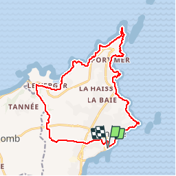

Length
18 km

Max alt
51 m

Uphill gradient
275 m
Km-Effort
22 km

Min alt
4 m

Downhill gradient
269 m
Boucle
Yes
Creation date :
2019-07-31 12:04:04.388
Updated on :
2019-08-04 10:31:24.949
5h17
Difficulty : Medium

FREE GPS app for hiking
 SityTrail
IGN / Geographical institutes
SityTrail Plus
The world is yours!
About
Trail Walking of 18 km to be discovered at Brittany, Ille-et-Vilaine, Cancale. This trail is proposed by gdela.
Description
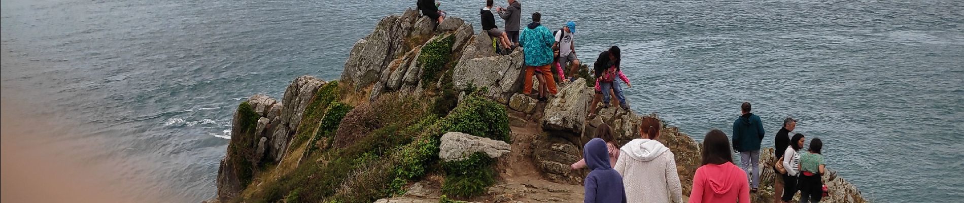
Cancale/Cancale en suivant le GR34 et GR34a
Photos


Positioning
Country:
France
Region :
Brittany
Department/Province :
Ille-et-Vilaine
Municipality :
Cancale
Location:
Unknown
Start:(Dec)
Start:(UTM)
584564 ; 5391671 (30U) N.
Comments