


ile aux pies coté 35

benoitrando
User

Length
4.8 km

Max alt
43 m

Uphill gradient
52 m
Km-Effort
5.6 km

Min alt
1 m

Downhill gradient
74 m
Boucle
No
Creation date :
2019-08-02 09:24:18.015
Updated on :
2019-08-02 11:54:20.915
1h12
Difficulty : Easy

FREE GPS app for hiking
 SityTrail
IGN / Geographical institutes
SityTrail Plus
The world is yours!
About
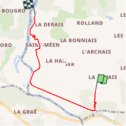
Trail Walking of 4.8 km to be discovered at Brittany, Ille-et-Vilaine, Bains-sur-Oust. This trail is proposed by benoitrando.
Positioning
Country:
France
Region :
Brittany
Department/Province :
Ille-et-Vilaine
Municipality :
Bains-sur-Oust
Location:
Unknown
Start:(Dec)
Start:(UTM)
567611 ; 5281522 (30T) N.
Comments