


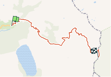
Col de la Fenêtre depuis Belleville

whisper73
User

Length
7.8 km

Max alt
2275 m

Uphill gradient
1054 m
Km-Effort
18.4 km

Min alt
1229 m

Downhill gradient
18 m
Boucle
No
Creation date :
2019-08-04 15:37:18.275
Updated on :
2019-08-04 15:41:15.587
2h45
Difficulty : Medium
10m
Difficulty : Medium

FREE GPS app for hiking
 SityTrail
IGN / Geographical institutes
SityTrail Plus
The world is yours!
About
Trail Walking of 7.8 km to be discovered at Auvergne-Rhône-Alpes, Savoy, Hauteluce. This trail is proposed by whisper73.
Positioning
Country:
France
Region :
Auvergne-Rhône-Alpes
Department/Province :
Savoy
Municipality :
Hauteluce
Location:
Unknown
Start:(Dec)
Start:(UTM)
316576 ; 5071510 (32T) N.
Comments