


brèche de Roland plus pied du puy mary

jeanic63
User
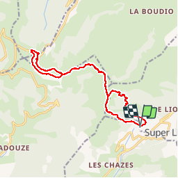

Length
16.8 km

Max alt
1650 m

Uphill gradient
689 m
Km-Effort
26 km

Min alt
1244 m

Downhill gradient
692 m
Boucle
Yes
Creation date :
2019-08-05 06:26:52.278
Updated on :
2019-08-05 17:22:08.868
6h16
Difficulty : Difficult

FREE GPS app for hiking
 SityTrail
IGN / Geographical institutes
SityTrail Plus
The world is yours!
About
Trail Walking of 16.8 km to be discovered at Auvergne-Rhône-Alpes, Cantal, Laveissière. This trail is proposed by jeanic63.
Description
départ bouton du font de cère
Positioning
Country:
France
Region :
Auvergne-Rhône-Alpes
Department/Province :
Cantal
Municipality :
Laveissière
Location:
Unknown
Start:(Dec)
Start:(UTM)
479032 ; 4992429 (31T) N.
Comments