


metab

vienne14400
User
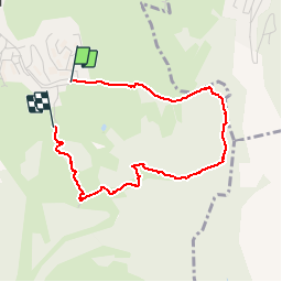

Length
3.3 km

Max alt
1131 m

Uphill gradient
125 m
Km-Effort
4.9 km

Min alt
1011 m

Downhill gradient
107 m
Boucle
No
Creation date :
2019-08-06 08:03:19.14
Updated on :
2019-08-06 09:17:55.308
1h14
Difficulty : Very easy

FREE GPS app for hiking
 SityTrail
IGN / Geographical institutes
SityTrail Plus
The world is yours!
About
Trail Walking of 3.3 km to be discovered at Bourgogne-Franche-Comté, Doubs, Métabief. This trail is proposed by vienne14400.
Positioning
Country:
France
Region :
Bourgogne-Franche-Comté
Department/Province :
Doubs
Municipality :
Métabief
Location:
Unknown
Start:(Dec)
Start:(UTM)
298356 ; 5182883 (32T) N.
Comments