


Tour de la Tête de Moïse

trailer.nono
User
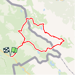

Length
19.7 km

Max alt
2748 m

Uphill gradient
1386 m
Km-Effort
38 km

Min alt
1941 m

Downhill gradient
1386 m
Boucle
Yes
Creation date :
2019-08-07 06:53:20.731
Updated on :
2019-08-07 21:11:45.743
6h31
Difficulty : Medium

FREE GPS app for hiking
 SityTrail
IGN / Geographical institutes
SityTrail Plus
The world is yours!
About
Trail Walking of 19.7 km to be discovered at Provence-Alpes-Côte d'Azur, Alpes-de-Haute-Provence, Val-d'Oronaye. This trail is proposed by trailer.nono.
Positioning
Country:
France
Region :
Provence-Alpes-Côte d'Azur
Department/Province :
Alpes-de-Haute-Provence
Municipality :
Val-d'Oronaye
Location:
Larche
Start:(Dec)
Start:(UTM)
332004 ; 4921563 (32T) N.
Comments