


La Bouldouire 9km

DiagMan
User
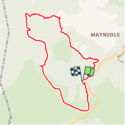

Length
9.5 km

Max alt
897 m

Uphill gradient
237 m
Km-Effort
12.7 km

Min alt
774 m

Downhill gradient
235 m
Boucle
Yes
Creation date :
2019-08-08 10:27:35.451
Updated on :
2019-08-08 15:36:09.725
3h23
Difficulty : Medium

FREE GPS app for hiking
 SityTrail
IGN / Geographical institutes
SityTrail Plus
The world is yours!
About
Trail Walking of 9.5 km to be discovered at Occitania, Aveyron, Bertholène. This trail is proposed by DiagMan.
Positioning
Country:
France
Region :
Occitania
Department/Province :
Aveyron
Municipality :
Bertholène
Location:
Unknown
Start:(Dec)
Start:(UTM)
482377 ; 4911360 (31T) N.
Comments