


Vaux sur aure jardi public 10 kms 2019

aubinjoel
User
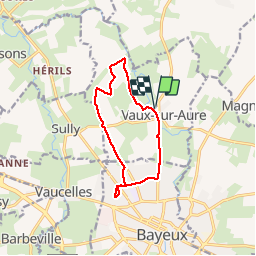

Length
10.1 km

Max alt
63 m

Uphill gradient
70 m
Km-Effort
11 km

Min alt
25 m

Downhill gradient
70 m
Boucle
Yes
Creation date :
2019-08-09 11:39:15.913
Updated on :
2019-08-09 11:40:28.701

FREE GPS app for hiking
 SityTrail
IGN / Geographical institutes
SityTrail Plus
The world is yours!
About
Trail of 10.1 km to be discovered at Normandy, Calvados, Vaux-sur-Aure. This trail is proposed by aubinjoel.
Positioning
Country:
France
Region :
Normandy
Department/Province :
Calvados
Municipality :
Vaux-sur-Aure
Location:
Unknown
Start:(Dec)
Start:(UTM)
666866 ; 5463853 (30U) N.
Comments