


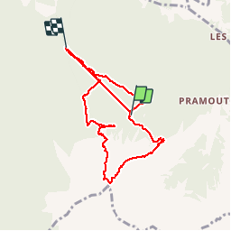
chalet de la biche . mont orel . chapelle de pra leydon . chalet de la coche

stef789
User GUIDE


4h59
Difficulty : Difficult

FREE GPS app for hiking
 SityTrail
IGN / Geographical institutes
SityTrail Plus
The world is yours!
About
Trail Walking of 9.4 km to be discovered at Provence-Alpes-Côte d'Azur, Hautes-Alpes, Saint-André-d'Embrun. This trail is proposed by stef789.
Description
le randonneur ardennais que je suus qualifierait cette randonnee de véritable tuerie : montee 2h40 hyper hard, pause 1h, descente 2h20 hyper hard - pas une minute de repos mais quelle magnifique rando
PS changement de batterie don petit bug dans le minutage indique
Photos


Positioning
Comments