Resteigne - Ermitage - Belvaux

vtaquin
User
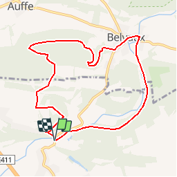

Length
8.6 km

Max alt
288 m

Uphill gradient
171 m
Km-Effort
10.9 km

Min alt
170 m

Downhill gradient
172 m
Boucle
Yes
Creation date :
2019-08-11 09:10:47.693
Updated on :
2019-08-18 10:10:22.995
2h11
Difficulty : Medium

FREE GPS app for hiking
 SityTrail
IGN / Geographical institutes
SityTrail Plus
The world is yours!
About
Trail Walking of 8.6 km to be discovered at Wallonia, Luxembourg, Tellin. This trail is proposed by vtaquin.
Description
Pass par l'ermitage masi aussi par le "pupitre" moins connu.
Positioning
Country:
Belgium
Region :
Wallonia
Department/Province :
Luxembourg
Municipality :
Tellin
Location:
Resteigne
Start:(Dec)
Start:(UTM)
655631 ; 5550950 (31U) N.
Comments