


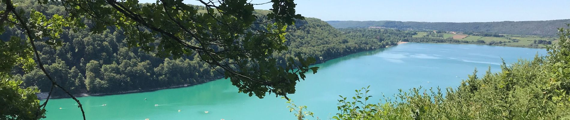
Tour du lac chalain

yves62410
User
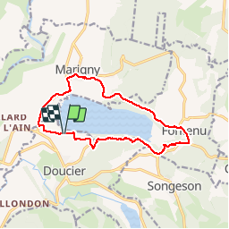

Length
13 km

Max alt
612 m

Uphill gradient
259 m
Km-Effort
16.5 km

Min alt
486 m

Downhill gradient
261 m
Boucle
Yes
Creation date :
2019-08-14 09:23:12.0
Updated on :
2019-08-14 13:27:13.452
4h03
Difficulty : Difficult

FREE GPS app for hiking
 SityTrail
IGN / Geographical institutes
SityTrail Plus
The world is yours!
About
Trail Walking of 13 km to be discovered at Bourgogne-Franche-Comté, Jura, Doucier. This trail is proposed by yves62410.
Description
Ne pas hésiter à le faire en sens inverse en cas de chaleur
Pas de difficulté
Photos


Positioning
Country:
France
Region :
Bourgogne-Franche-Comté
Department/Province :
Jura
Municipality :
Doucier
Location:
Unknown
Start:(Dec)
Start:(UTM)
712499 ; 5171827 (31T) N.
Comments