


Lac jovet et retour

chriszy
User

Length
8.4 km

Max alt
2180 m

Uphill gradient
996 m
Km-Effort
18.4 km

Min alt
1197 m

Downhill gradient
16 m
Boucle
No
Creation date :
2019-08-14 06:51:44.0
Updated on :
2019-08-14 14:20:11.715
3h43
Difficulty : Difficult

FREE GPS app for hiking
 SityTrail
IGN / Geographical institutes
SityTrail Plus
The world is yours!
About
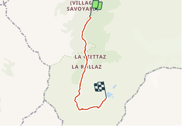
Trail Walking of 8.4 km to be discovered at Auvergne-Rhône-Alpes, Upper Savoy, Les Contamines-Montjoie. This trail is proposed by chriszy.
Positioning
Country:
France
Region :
Auvergne-Rhône-Alpes
Department/Province :
Upper Savoy
Municipality :
Les Contamines-Montjoie
Location:
Unknown
Start:(Dec)
Start:(UTM)
322648 ; 5073794 (32T) N.
Comments