


au dessus d Aulp

stef789
User GUIDE
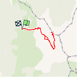

Length
7.2 km

Max alt
2053 m

Uphill gradient
719 m
Km-Effort
16.8 km

Min alt
1428 m

Downhill gradient
721 m
Boucle
Yes
Creation date :
2019-08-14 11:35:29.297
Updated on :
2019-08-14 15:12:34.204
3h35
Difficulty : Difficult

FREE GPS app for hiking
 SityTrail
IGN / Geographical institutes
SityTrail Plus
The world is yours!
About
Trail Walking of 7.2 km to be discovered at Auvergne-Rhône-Alpes, Upper Savoy, Talloires-Montmin. This trail is proposed by stef789.
Description
monte monte monte et puis descend descend descend
Photos


Positioning
Country:
France
Region :
Auvergne-Rhône-Alpes
Department/Province :
Upper Savoy
Municipality :
Talloires-Montmin
Location:
Talloires
Start:(Dec)
Start:(UTM)
287485 ; 5078999 (32T) N.
Comments