Trail Trail Lus-la-Croix-Haute - Grand Ferrand 2758 m - Photo
© OpenStreetMap contributors
Length
Length
18.7 km
Max alt
Max alt
2744 m
Uphill gradient
Uphill gradient
1782 m
Km-Effort
Km-Effort  
42 km
Min alt
Min alt
1215 m
Downhill gradient
Downhill gradient
1777 m
Boucle
Boucle
Yes
Creation date :
2019-08-14 07:08:48.0
Updated on :
2019-08-14 16:27:36.114

(0 Reviews)

Trail
Trail
5h50
Difficulty : Unknown

Scan this QR Code to open this trail in the SityTrail application

FREE GPS app for hiking

Logo SityTrail SityTrail

IGN / Geographical institutes

Download SityTrail from the App Store Download SityTrail from Google Play

Logo SityTrail SityTrail Plus

The world is yours!

Download SityTrail from the App Store Download SityTrail from Google Play Download SityTrail on Huawei AppGallery

About

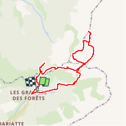
Trail Trail of 18.7 km to be discovered at Auvergne-Rhône-Alpes, Drôme, Lus-la-Croix-Haute. This trail is proposed by Atchoum26.

Description

Col de La Croix  1497 m - Col des Aurias 1782 m - Col du Charnier 2103 m - Grand Ferrand 2758 m - Tête de Vallon Pierra 2516 m - Col du Charnier 2103 m - Lac du Lauzon 1953 m - Cabane du Fleyrard 1594 m - Saboyer 1228 m

Elevation profile

Positioning

Country:
France
Region :
Auvergne-Rhône-Alpes
Department/Province :
Drôme
Municipality :
Lus-la-Croix-Haute
Location:
Unknown
Start:(UTM)
720216 ; 4952429 (31T) N.


Close
My subscriptions