


taulelles 27 aout

elorthiois
User
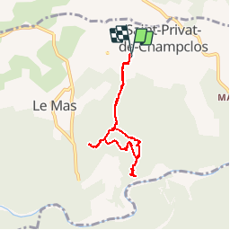

Length
6.8 km

Max alt
242 m

Uphill gradient
174 m
Km-Effort
9.1 km

Min alt
150 m

Downhill gradient
174 m
Boucle
Yes
Creation date :
2014-12-10 00:00:00.0
Updated on :
2014-12-10 00:00:00.0
1h09
Difficulty : Unknown

FREE GPS app for hiking
 SityTrail
IGN / Geographical institutes
SityTrail Plus
The world is yours!
About
Trail Walking of 6.8 km to be discovered at Occitania, Gard, Saint-Privat-de-Champclos. This trail is proposed by elorthiois.
Positioning
Country:
France
Region :
Occitania
Department/Province :
Gard
Municipality :
Saint-Privat-de-Champclos
Location:
Unknown
Start:(Dec)
Start:(UTM)
608680 ; 4904367 (31T) N.
Comments