


Âprement

lorenzot54
User
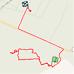

Length
5.3 km

Max alt
379 m

Uphill gradient
48 m
Km-Effort
6 km

Min alt
351 m

Downhill gradient
61 m
Boucle
No
Creation date :
2019-08-14 11:48:16.0
Updated on :
2019-08-15 11:35:19.745
2h10
Difficulty : Unknown

FREE GPS app for hiking
 SityTrail
IGN / Geographical institutes
SityTrail Plus
The world is yours!
About
Trail Walking of 5.3 km to be discovered at Grand Est, Meuse, Apremont-la-Forêt. This trail is proposed by lorenzot54.
Description
Découverte historique du saillant de St Mihiel
Positioning
Country:
France
Region :
Grand Est
Department/Province :
Meuse
Municipality :
Apremont-la-Forêt
Location:
Apremont-la-Forêt
Start:(Dec)
Start:(UTM)
692560 ; 5414982 (31U) N.
Comments