


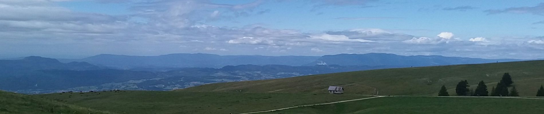
petit tour de Semnoz piste

stef789
User GUIDE
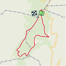

Length
7.6 km

Max alt
1694 m

Uphill gradient
352 m
Km-Effort
12.3 km

Min alt
1449 m

Downhill gradient
350 m
Boucle
Yes
Creation date :
2019-08-15 09:56:02.954
Updated on :
2019-08-15 12:43:05.855
2h44
Difficulty : Very easy

FREE GPS app for hiking
 SityTrail
IGN / Geographical institutes
SityTrail Plus
The world is yours!
About
Trail Walking of 7.6 km to be discovered at Auvergne-Rhône-Alpes, Upper Savoy, Leschaux. This trail is proposed by stef789.
Photos

Positioning
Country:
France
Region :
Auvergne-Rhône-Alpes
Department/Province :
Upper Savoy
Municipality :
Leschaux
Location:
Unknown
Start:(Dec)
Start:(UTM)
274740 ; 5075093 (32T) N.
Comments