


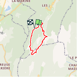
La Ruchère/Les Riondettes - col de l'Arpison - col de la Ruchère

maupassant38
User

Length
9.6 km

Max alt
1505 m

Uphill gradient
453 m
Km-Effort
15.6 km

Min alt
1261 m

Downhill gradient
453 m
Boucle
Yes
Creation date :
2019-08-15 08:56:35.918
Updated on :
2019-08-15 15:12:50.218
3h01
Difficulty : Medium

FREE GPS app for hiking
 SityTrail
IGN / Geographical institutes
SityTrail Plus
The world is yours!
About
Trail Walking of 9.6 km to be discovered at Auvergne-Rhône-Alpes, Isère, Saint-Christophe-sur-Guiers. This trail is proposed by maupassant38.
Positioning
Country:
France
Region :
Auvergne-Rhône-Alpes
Department/Province :
Isère
Municipality :
Saint-Christophe-sur-Guiers
Location:
Unknown
Start:(Dec)
Start:(UTM)
717879 ; 5030326 (31T) N.
Comments