


X cartir

chriszy
User
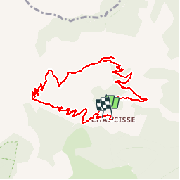

Length
10.8 km

Max alt
1827 m

Uphill gradient
519 m
Km-Effort
17.9 km

Min alt
1288 m

Downhill gradient
552 m
Boucle
No
Creation date :
2019-08-16 08:27:44.0
Updated on :
2019-08-16 12:42:07.822
3h49
Difficulty : Difficult

FREE GPS app for hiking
 SityTrail
IGN / Geographical institutes
SityTrail Plus
The world is yours!
About
Trail Walking of 10.8 km to be discovered at Auvergne-Rhône-Alpes, Savoy, Saint-Nicolas-la-Chapelle. This trail is proposed by chriszy.
Positioning
Country:
France
Region :
Auvergne-Rhône-Alpes
Department/Province :
Savoy
Municipality :
Saint-Nicolas-la-Chapelle
Location:
Unknown
Start:(Dec)
Start:(UTM)
304353 ; 5078031 (32T) N.
Comments