


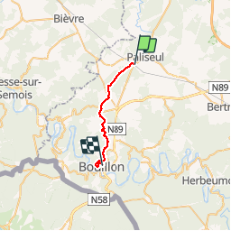
Paliseul bouillon

vrenneson
User

Length
18 km

Max alt
461 m

Uphill gradient
413 m
Km-Effort
24 km

Min alt
223 m

Downhill gradient
581 m
Boucle
No
Creation date :
2019-08-16 08:39:14.881
Updated on :
2019-08-16 14:59:27.856
4h30
Difficulty : Very easy

FREE GPS app for hiking
 SityTrail
IGN / Geographical institutes
SityTrail Plus
The world is yours!
About
Trail Walking of 18 km to be discovered at Wallonia, Luxembourg, Paliseul. This trail is proposed by vrenneson.
Positioning
Country:
Belgium
Region :
Wallonia
Department/Province :
Luxembourg
Municipality :
Paliseul
Location:
Paliseul
Start:(Dec)
Start:(UTM)
652146 ; 5529169 (31U) N.
Comments