


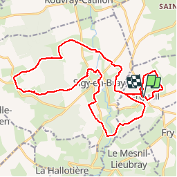
Argueil - Sigy en Bray - Mont Sigy

MichelRando7656
User

Length
21 km

Max alt
222 m

Uphill gradient
352 m
Km-Effort
26 km

Min alt
99 m

Downhill gradient
352 m
Boucle
Yes
Creation date :
2019-08-18 09:03:59.698
Updated on :
2019-08-18 15:39:56.697
6h34
Difficulty : Difficult

FREE GPS app for hiking
 SityTrail
IGN / Geographical institutes
SityTrail Plus
The world is yours!
About
Trail Walking of 21 km to be discovered at Normandy, Seine-Maritime, Argueil. This trail is proposed by MichelRando7656.
Description
Superbes chemins de campagne et beaux panoramas.
Photos


Positioning
Country:
France
Region :
Normandy
Department/Province :
Seine-Maritime
Municipality :
Argueil
Location:
Unknown
Start:(Dec)
Start:(UTM)
392498 ; 5488771 (31U) N.
Comments