


Ault - Bois de la cise

Blourouce
User
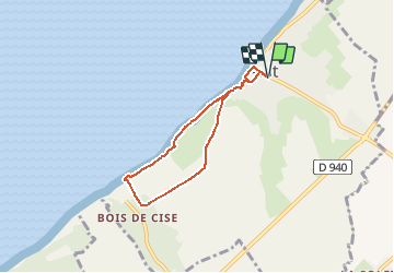

Length
5.1 km

Max alt
82 m

Uphill gradient
121 m
Km-Effort
6.7 km

Min alt
16 m

Downhill gradient
121 m
Boucle
Yes
Creation date :
2019-08-19 18:56:01.641
Updated on :
2019-08-19 19:02:16.419
1h29
Difficulty : Medium

FREE GPS app for hiking
 SityTrail
IGN / Geographical institutes
SityTrail Plus
The world is yours!
About
Trail Walking of 5.1 km to be discovered at Hauts-de-France, Somme, Ault. This trail is proposed by Blourouce.
Positioning
Country:
France
Region :
Hauts-de-France
Department/Province :
Somme
Municipality :
Ault
Location:
Unknown
Start:(Dec)
Start:(UTM)
389012 ; 5550990 (31U) N.
Comments