


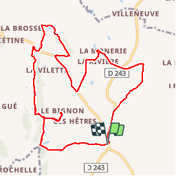
Niort-la-Fontaine; trace GPS du 21/08/2019

toporient
User

Length
10.8 km

Max alt
184 m

Uphill gradient
163 m
Km-Effort
13 km

Min alt
125 m

Downhill gradient
165 m
Boucle
Yes
Creation date :
2019-08-21 11:20:57.827
Updated on :
2019-09-03 11:49:19.449
3h47
Difficulty : Very easy

FREE GPS app for hiking
 SityTrail
IGN / Geographical institutes
SityTrail Plus
The world is yours!
About
Trail Walking of 10.8 km to be discovered at Pays de la Loire, Mayenne, Lassay-les-Châteaux. This trail is proposed by toporient.
Positioning
Country:
France
Region :
Pays de la Loire
Department/Province :
Mayenne
Municipality :
Lassay-les-Châteaux
Location:
Niort-la-Fontaine
Start:(Dec)
Start:(UTM)
681907 ; 5367725 (30U) N.
Comments