


2019 08 ANDORE T3

michel1025
User
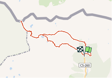

Length
10.4 km

Max alt
2899 m

Uphill gradient
944 m
Km-Effort
23 km

Min alt
1950 m

Downhill gradient
946 m
Boucle
Yes
Creation date :
2019-08-21 08:10:40.0
Updated on :
2019-08-21 16:57:58.678
5h41
Difficulty : Unknown

FREE GPS app for hiking
 SityTrail
IGN / Geographical institutes
SityTrail Plus
The world is yours!
About
Trail Walking of 10.4 km to be discovered at Andorra. This trail is proposed by michel1025.
Positioning
Country:
Andorra
Region :
Canillo
Department/Province :
Canillo
Municipality :
el Tarter
Location:
Unknown
Start:(Dec)
Start:(UTM)
388255 ; 4718535 (31T) N.
Comments