


Murailles du Vercors

PhilippeC54
User

Length
58 km

Max alt
1010 m

Uphill gradient
1509 m
Km-Effort
78 km

Min alt
178 m

Downhill gradient
1511 m
Boucle
Yes
Creation date :
2019-08-23 07:50:29.857
Updated on :
2019-08-23 13:44:43.119
4h54
Difficulty : Difficult

FREE GPS app for hiking
 SityTrail
IGN / Geographical institutes
SityTrail Plus
The world is yours!
About
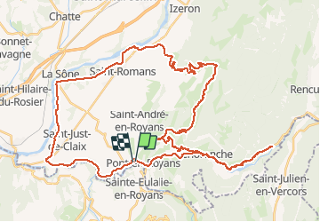
Trail Road bike of 58 km to be discovered at Auvergne-Rhône-Alpes, Isère, Pont-en-Royans. This trail is proposed by PhilippeC54.
Description
circuit #1
plus variante par les gorges de la Bourne
Positioning
Country:
France
Region :
Auvergne-Rhône-Alpes
Department/Province :
Isère
Municipality :
Pont-en-Royans
Location:
Unknown
Start:(Dec)
Start:(UTM)
683961 ; 4992667 (31T) N.
Comments