


2019 08 ANDORRE T4

michel1025
User
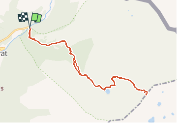

Length
11.9 km

Max alt
2899 m

Uphill gradient
1142 m
Km-Effort
27 km

Min alt
1792 m

Downhill gradient
1144 m
Boucle
Yes
Creation date :
2019-08-22 07:17:20.0
Updated on :
2019-08-23 17:35:19.611
7h04
Difficulty : Unknown

FREE GPS app for hiking
 SityTrail
IGN / Geographical institutes
SityTrail Plus
The world is yours!
About
Trail Walking of 11.9 km to be discovered at Andorra. This trail is proposed by michel1025.
Positioning
Country:
Andorra
Region :
Ordino
Department/Province :
Ordino
Municipality :
el Serrat
Location:
Unknown
Start:(Dec)
Start:(UTM)
381252 ; 4720274 (31T) N.
Comments