


SNS BEAULIEU EN ARGONNE

Patrick Martinus
User

Length
16.2 km

Max alt
305 m

Uphill gradient
354 m
Km-Effort
21 km

Min alt
175 m

Downhill gradient
357 m
Boucle
Yes
Creation date :
2019-08-24 07:15:10.619
Updated on :
2019-08-24 07:19:22.567
4h29
Difficulty : Very difficult

FREE GPS app for hiking
 SityTrail
IGN / Geographical institutes
SityTrail Plus
The world is yours!
About
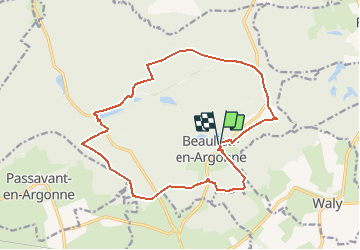
Trail Walking of 16.2 km to be discovered at Grand Est, Meuse, Beaulieu-en-Argonne. This trail is proposed by Patrick Martinus.
Description
Départ et arrivée au parking de l'Abbaye
Positioning
Country:
France
Region :
Grand Est
Department/Province :
Meuse
Municipality :
Beaulieu-en-Argonne
Location:
Unknown
Start:(Dec)
Start:(UTM)
651208 ; 5433173 (31U) N.
Comments