


25-08-2019 presles

Coux
User
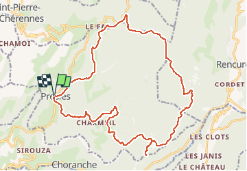

Length
24 km

Max alt
1381 m

Uphill gradient
965 m
Km-Effort
37 km

Min alt
840 m

Downhill gradient
965 m
Boucle
Yes
Creation date :
2019-08-25 07:25:03.133
Updated on :
2019-08-25 15:18:31.673
7h50
Difficulty : Very easy

FREE GPS app for hiking
 SityTrail
IGN / Geographical institutes
SityTrail Plus
The world is yours!
About
Trail Walking of 24 km to be discovered at Auvergne-Rhône-Alpes, Isère, Presles. This trail is proposed by Coux.
Positioning
Country:
France
Region :
Auvergne-Rhône-Alpes
Department/Province :
Isère
Municipality :
Presles
Location:
Unknown
Start:(Dec)
Start:(UTM)
687467 ; 4995879 (31T) N.
Comments